
Restaurant
Restaurante Salvado Pou des Lleo
2.7 km away
Authentic seaside dishes with views of fishermen's huts and traditional flavors.


Photo credits
Beach · Santa Eulària des Riu
A small private island off the north-east coast of Ibiza, reachable only by boat. A protected natural area with cliffs, caves and a lighthouse from 1913.
Tagomago isn’t an ordinary beach but a small island off the north-east coast of Ibiza. It lies opposite the coast at Es Figueral and belongs to the municipality of Santa Eulària des Riu. The island is privately owned.
Tagomago is about 1.5 km long and covers some 60 hectares. Its highest point is about 115 metres above sea level. The coast consists mostly of cliffs, with many caves.
According to the town council, the island has a house, a seasonal facility and a lighthouse. The lighthouse was built in 1913. The accommodation on the island is rented out to holidaymakers.
The name is often linked to the Carthaginian general Mago, a brother of Hannibal. The linguist Joan Coromines, however, considers a pre-Roman origin more likely.
Tagomago and the sea around it are protected as a Natura 2000 site. Seabirds such as the Balearic shearwater and Audouin’s gull breed on the islets off the coast of Santa Eulària. Birds of prey also breed on Tagomago. Of all these islets, Eleonora’s falcon breeds only on Tagomago. There are also local forms of the Ibiza wall lizard.
Underwater there are meadows of posidonia, a protected seagrass. The town council also lists the loggerhead turtle and the bottlenose dolphin among the species in this marine area.
Tagomago can only be reached by water: on your own or a hired boat, or on a boat trip that calls at the island. It’s private property, so expect to see the island mainly from the water, swimming or snorkelling from the boat.
There are no facilities you can count on as a day visitor. The seasonal facility on the island isn’t necessarily open to visitors. Bring enough water, food and sun protection on board.
Natura 2000 management plan ‘Illots de Llevant d’Eivissa’ (Govern de les Illes Balears)
This text was written with AI assistance and has not yet been reviewed by our editors. Editorial policy
These details come from open data sources and have not been checked by IBIZAMAP yet. Check them before you go.
2.7 km away
Authentic seaside dishes with views of fishermen's huts and traditional flavors.
 Secret spot
2.8 km away
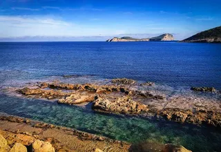
A strikingly straight channel running through a rock platform near Pou des Lleó, on Ibiza’s north-east coast.
2.9 km away
Family-run restaurant with wood fire, local seafood, traditional rice dishes and garden-grown produce.