.JPG)
.JPG)
.JPG)

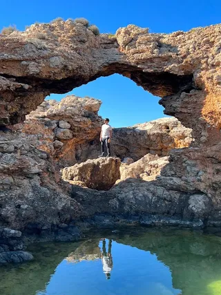 Secret spot
Punta des Jondal
A rocky headland on Ibiza’s south coast, about 1.4 km south-south-east of Cala Jondal. No facilities, and no checked route yet.


Secret spot · Sant Josep de sa Talaia
An anti-aircraft battery (designed in 1940) with a tunnel above Es Bol Nou beach (Sa Caleta), next to a Phoenician settlement. The beach is closed.
On the south coast of Ibiza, about 9.5 km from Ibiza Town, lies the small cove of Es Bol Nou, also known as Sa Caleta. It belongs to the municipality of Sant Josep de sa Talaia and stands out for its reddish clay cliffs. On the headland to the west are two pieces of history: a military battery and the remains of a Phoenician settlement.
The anti-aircraft battery was designed in 1940 under what was known as the Plan Kindelán. The plan was meant to strengthen Spain’s coastal defences against the backdrop of the Second World War. The battery protected the es Codolar airfield and the port of Ibiza Town.
The complex includes two gun emplacements, four machine-gun nests, a barracks and underground passages. The army abandoned the battery in 1962 and removed the guns. Since 2015 it has been protected as a Bien de Interés Cultural.
The tunnel in this spot’s name isn’t a natural passage. Behind the large barracks, a trench turns into a tunnel. It comes out above the beach, about 6 metres above the ground.
A little further along the same headland, sa Mola de sa Caleta, lie the remains of a Phoenician settlement. It may have been founded in the 8th century BC, grew around the middle of the 7th century BC and was abandoned around 590 BC. The finds shed light on the earliest phase of the Phoenician colonisation of Ibiza.
Since 1999 the settlement has been part of the UNESCO World Heritage Site ‘Ibiza, Biodiversity and Culture’. Since 2010 the site has been owned by the Consell d’Eivissa. The remains are modest and fenced off.
Follow the airport road and, close to the airport, take the turning on the left towards Cala Jondal. After about 4 km, an unsurfaced road leads to Sa Caleta. There’s a car park by the cove.
Before the closure, the route to the tunnel and the battery ran along the path between the beach and the restaurant. It isn’t known whether the battery and the settlement can now be reached another way. Always follow the signs and barriers on site.
This text was written with AI assistance and has not yet been reviewed by our editors. Editorial policy
These details come from open data sources and have not been checked by IBIZAMAP yet. Check them before you go.
Secret spotA rocky headland on Ibiza’s south coast, about 1.4 km south-south-east of Cala Jondal. No facilities, and no checked route yet.
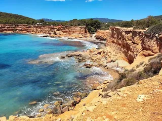 Beach
Beach48 m away
A small cove with red clay cliffs by the Phoenician site of Sa Caleta. Closed since April 2025 because of the risk of rockfalls (as of October 2026).
86 m away
Authentic seaside restaurant with fresh fish, relaxed vibe, and delicious paella.
1.2 km away
Traditional Spanish cuisine by the sea with warm and attentive service.
1.3 km away
Beach club with live music, refined dishes, and glamorous vibes from afternoon to night.
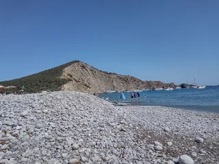 Beach
Beach1.5 km away
A pebble beach on the south coast in Sant Josep, also called Cala Jondal. Known for its beach restaurants, beach clubs and yachts anchored in the bay.